
|
July 06, 2021 CC BY 4.0 |
print |
Keywords: archaeology of cartography | city | critical cartography | early-modern | england | historical geography | landscapes | lieux de savoir | maps | medieval | surveying
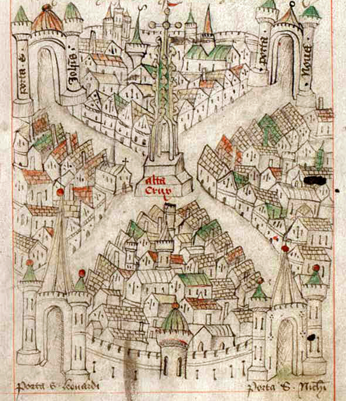 View of Bristol, Robert Ricart, The Maire of Bristowe is Kalendar (c. 1479–80) (Bristol, Bristol Record Office (BRO) 04720, fol. 3b)
The impacts and influences of Foucault's philosophies on geography and cartography are great. This paper takes a different approach to this "critical cartography," however, by focusing not just on the map-image but on map-sites by exploring "the field" as a site of cartographic practice. It does so by drawing on Christian Jacob's idea of maps as lieu de savoir, and takes this in a new direction through placing maps within the landscape as a lieu de savoir. To do this the paper focuses on three English provincial cities to situate the late-medieval and early-modern maps attributed to Ranulf Higden, Robert Ricart and William Cuningham. Through "excavating" the locales of mapmaking and their sites of survey, connecting maps with landscapes historically and geographically, what emerges is a critical intersectional approach, an "archaeology of cartography."
Keith D. Lilley: "Mapping Sites: Lieux de Savoir in the Practice of Urban Cartography, 1340–1560," in: Le foucaldien, 7/1 (2021), DOI: 10.16995/lefou.96
Commenting is closed for this article.